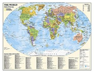
Political map of the world for grades 4-12. National Geographic’s graded-series of maps are the first to address the unique needs of K-12 students as they advance their understanding
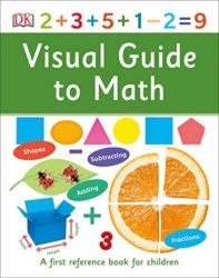
Key math vocabulary and concepts for young children explained simply in this friendly and informative reference book. Clear, accessible pictures and diagrams support this first introduction to numbers, calculating,
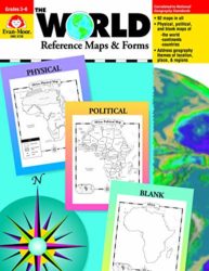
The World Reference Maps & Forms contains 92 maps, evaluation forms, a crossword puzzle, a word search, and an answer key. The first section, The World, includes: -an introduction
Up-to-date, reliable information about Tourette Syndrome and related disorders for teachers and parents Children with TS are often teased and punished for the unusual yet uncontrollable symptoms of their
The DK First Atlas brings each continent and country to life, making geographic concepts easy to understand. Packed with detailed pictorial maps specially designed for young readers, this First
Drugs and alcohol. Self-injury. Eating disorders. Puberty. Suicide. Sexual purity. These are just a few of the challenges facing teens and young adults today. This concise, topical guide to